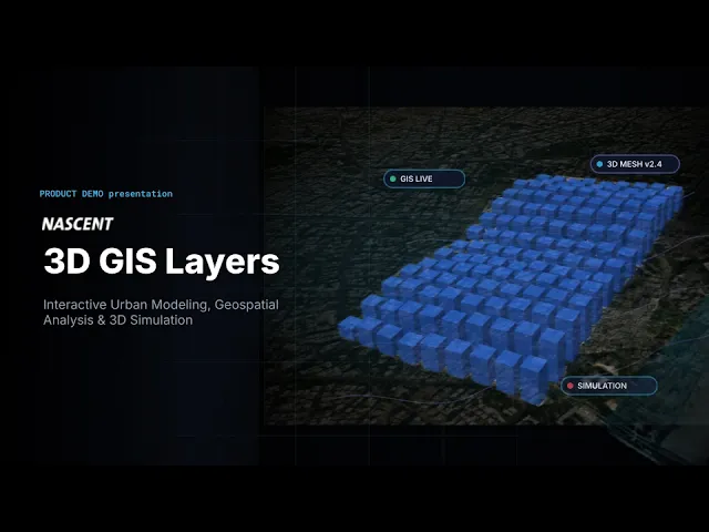
3D GIS Layers
3D GIS Layers
Shipped
Shipped
2026
2026
Modernizing Spatial GIS for High-Stakes Urban Planning
Modernizing Spatial GIS for High-Stakes Urban Planning

Role
Role
Lead Product Designer
Lead Product Designer
Company
Nascent Info Tech
Domain
Domain
Enterprise B2B / Gov. Urban Planning
Enterprise B2B / Gov. Urban Planning
Timeline
Timeline
4-Week MVP Sprint
4-Week MVP Sprint
Team
Team
HOO, GIS Expert
HOO, GIS Expert
Overview
Overview
Users did not want another complicated GIS software.
Users did not want another complicated GIS software.
Users (municipal operators) wanted accessible urban planning tools instead of fighting through extreme cognitive overload and multi-nested windows. We ran a 4-week sprint to build 3D City Layers to solve that, but spatial data is inherently complicated. We needed to design a complex digital twin platform like it was simple.
Users (municipal operators) wanted accessible urban planning tools instead of fighting through extreme cognitive overload and multi-nested windows. We ran a 4-week sprint to build 3D City Layers to solve that, but spatial data is inherently complicated. We needed to design a complex digital twin platform like it was simple.
Solution
Solution
A simplified 3D platform that empowered operators to visualize data.
A simplified 3D platform that empowered operators to visualize data.

Impact
Impact
Pioneering Market Entry
Delivered an interactive 3D GIS prototype to help Nascent enter the Indian smart-city market.
Pioneering Market Entry
Delivered an interactive 3D GIS prototype to help Nascent enter the Indian smart-city market.
Pioneering Market Entry
Delivered an interactive 3D GIS prototype to help Nascent enter the Indian smart-city market.
Sales Enablement
Streamlined sales demos with a scannable product interface.
Sales Enablement
Streamlined sales demos with a scannable product interface.
Sales Enablement
Streamlined sales demos with a scannable product interface.
Foundational System
Used material component library to speed up development
Foundational System
Used material component library to speed up development
Foundational System
Used material component library to speed up development
Discovery
Discovery
Users were losing it, abandoning the platform.
Users were losing it, abandoning the platform.
Internal Alignment
Sales and onboarding teams knew exactly where we were losing people. We talked to the solution architects, and they pointed straight to the initial setup. Non-technical users, like city commissioners, were abandoning the platform as soon as they tried to configure layers.
Sales and onboarding teams knew exactly where we were losing people. We talked to the solution architects, and they pointed straight to the initial setup. Non-technical users, like city commissioners, were abandoning the platform as soon as they tried to configure layers.
Industry Pain Points
The rest of the market was making the exact same design mistakes. We evaluated over ten different GIS platforms to see how they handled these workflows. The standard tools were full of the same complicated friction patterns that kept everyday users out.
The rest of the market was making the exact same design mistakes. We evaluated over ten different GIS platforms to see how they handled these workflows. The standard tools were full of the same complicated friction patterns that kept everyday users out.
Key Friction Patterns
Canvas Clutter- fixed Inspection panels crowding 3D viewport real estate.
Multi-Task Confusion- panels mixing viewport controls, layer filters, and metadata inputs into a singular chaotic views.
Lack of Guidance- zero progressive disclosure during complex spatial queries.
Canvas Clutter- fixed Inspection panels crowding 3D viewport real estate.
Multi-Task Confusion- panels mixing viewport controls, layer filters, and metadata inputs into a singular chaotic views.
Lack of Guidance- zero progressive disclosure during complex spatial queries.
Design Process
Design Process
How can we humanize the 3D GIS software?
How can we humanize the 3D GIS software?
During intense brainstorming sessions, discussions around translating jargon into plain language, designing for natural mental models, removing the fear of breaking things, and focusing on the story rather than the data, helped us define exactly what it meant to 'humanize' the platform for everyday municipal workers.
During intense brainstorming sessions, discussions around translating jargon into plain language, designing for natural mental models, removing the fear of breaking things, and focusing on the story rather than the data, helped us define exactly what it meant to 'humanize' the platform for everyday municipal workers.


3D GIS Softwares avaialble in the market
3D GIS Softwares avaialble in the market
Design Decision
Design Decision
We took 5 Major design decisions to address the user's needs
We took 5 Major design decisions to address the user's needs
Decision 1: Single-Responsibility Panels
Decision 1: Single-Responsibility Panels
Instead of traditional nested floating toolbars, implemented a docked, collapsible panel system
Instead of traditional nested floating toolbars, implemented a docked, collapsible panel system

Decision 2: Progressive Disclosure
Decision 2: Progressive Disclosure
Structured multi-step configurations into guided, step-by-step drawers with smart defaults.
Structured multi-step configurations into guided, step-by-step drawers with smart defaults.

Decision 3: Design Familiarity
Decision 3: Design Familiarity
Adopted and modified Google's Material Design (M3) components, keyboard shortcuts with contextual tool tips.
Adopted and modified Google's Material Design (M3) components, keyboard shortcuts with contextual tool tips.

Decision 4: Unified Menu Architecture
Decision 4: Unified Menu Architecture
All tools organized into a single horizontal menu bar
All tools organized into a single horizontal menu bar

Decision 5: Interactive Help Mode
Decision 5: Interactive Help Mode
Interactive tutorial system….
Interactive tutorial system….
